
Salt Pond Preserve: To See the Forest for the Trees
I will be the first to admit that, in general, my writing tends to gravitate towards gravitas. Verdant coastal isles, summer colonies and railroads, isolated wildernesses–these are settings straight out of a dime novel. But for all my prattling, I have yet to dive into our state’s most bountiful and significant natural resource: our forests. Maine is the most forested state in the country, at an estimated 89% forest cover; in fact, if it was a sovereign nation, it would rank sixth globally in this metric (1,2). Our culture, our demography, our economy–all are intertwined with these woodlands. But what is a forest without its trees? Today I’ll be taking a closer look at a fantastic example of local New England-Acadian forest, thriving in the heart of Frenchman’s Bay: the Salt Pond Preserve.
Salutations and Spruces
Hello again; Michael MV checking in. Now, the discussion of trees and forests isn’t exactly a groundbreaking topic. When you’re up in the state, it’s just kind of a given–Maine without woods is like Bar Harbor without soul-crushing traffic. But this is not the case nationwide. I was born, and lived the majority of my life, twelve miles from Philadelphia’s City Hall. Forest is the exception down there, not the expectation–and my early summers up in Gouldsboro were transformative for this reason. Starting around High School I began cataloging the tree species on the north end of the Corean Peninsula (patent pending), and from there my passion only grew. Nowadays I consider myself a bit of a Maine tree nerd–but enough backstory. Let’s get into it.
Birches, Beaches and Brine: A Survey of Salt Pond
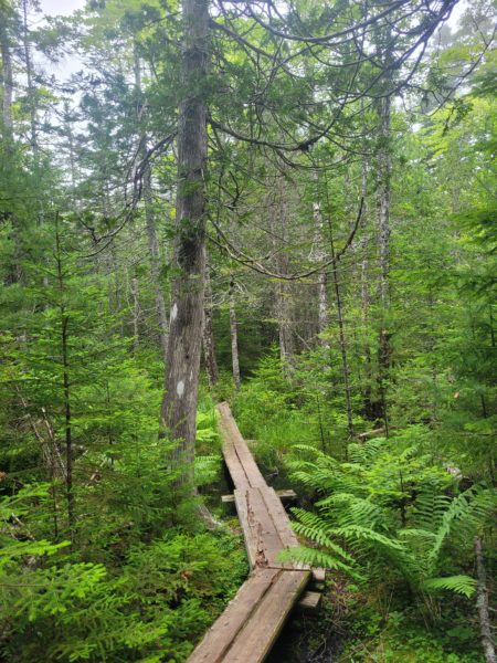
The trail does have some bog bridging, so please be careful, especially if the boards are wet as they can be slippery!
FBC’s Salt Pond Preserve is located close to the southern terminus of Hancock Point. Eighteen acres of woodland with frontage on the eponymous Salt Pond, it’s among our smaller preserves and shorter hikes. Starting from the small roadside parking area the trail slowly descends through half a mile of woodland, with a short loop towards the beginning, before reaching its terminus at a beach. This is Carter’s Beach, a property managed by fellow conservation group Crabtree Neck Land Trust. Finally, a short distance to the left from the trail’s end is the saline pond in question, which can be viewed from this location.
The trail itself is well maintained and easy to navigate, though the omnipresent web of tree routes is something to keep an eye out for. There are also several bogbridges located throughout its course; these can be slippery when conditions are wet, so I’d recommend having a handhold on nearby trees in these circumstances. And, like nearly all of the state’s trails, damp conditions are favored by our six-legged residents. Expect some buggy admirers on muggy days.
If a Tree Falls in the Woods: Conferring with the Conifers
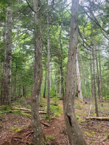
But just what is it that makes a Downeast forest unique? As one travels eastwards on Coastal Route 1, there is a decided change in the scenery: forests become mossier, the trees piney-er, the rare wildlife a little more numerous. Part of this can be explained by a change in ecosystem. Southern and western Maine largely consists of the temperate and more southerly Northeastern Coastal Forest. But, like a wave that arches from the mountains of New Hampshire down to the Hancock and Washington county coastlines, it changes into New England-Acadian Forest. This is the transitional forest between the temperate broadleaf ecosystems of the south and the boreal forest, or taiga, of northern Canada. Representing a mix of both these worlds, Downeast is home to countless species in either their southernmost or northernmost range.
There’s a bit of a unique backstory to many of our trees as well. As late as 12,000 years ago, the Maine coast was covered by the Laurentide Ice Sheet–a massive, mile-thick bulwark of ice. When this glacier retreated–carving our unique coastline in the process–the climate was much colder, and the exposed land transitioned from tundra to taiga. But, while rapidly increasing temperatures saw most of the region’s heat-sensitive trees dying out, the cool climate of the Gulf of Maine allowed them to continue flourishing along its eastern coast. Many of our common Downeastern species–paper birch, balsam fir, eastern larch, black and white spruce–are the main components as our continent’s northernmost forests. This also applies to many of our shrubs, wildflowers and mosses, with subarctic species like cloudberry, black crowberry and bristle-pointed iris growing locally.
Sally Forth to Salt Pond
But let’s get a little more specific here. Salt Pond is a prime example of New England-Acadian forest, and as such, the tree species I encountered were quite typical of the region. These, of course, are only a fraction of the flora and fauna present, but life is far too short for that blog post.
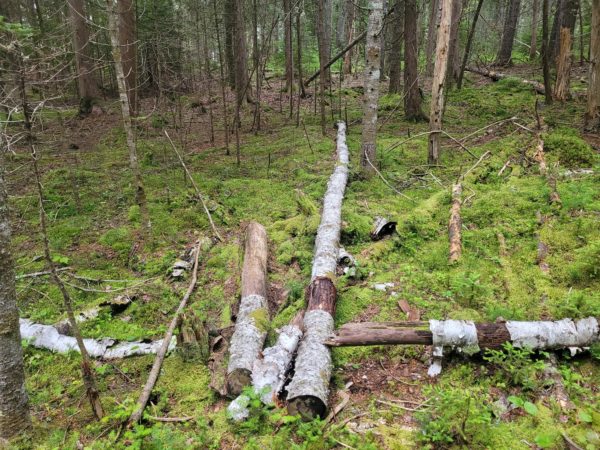
Northern White Cedar trees along the Salt Pond trail.
I’ll begin with the most numerous species on the preserve: Picea rubens, the red spruce. These trees, bearing short, tightly-packed needles and gray scaly bark, are the bread and butter of Downeast woodlands. Though they usually grow in the traditional “Christmas tree” shape, our dense forests tend to breed bald trunks with crested heads at the top.
Thriving in tandem with the red spruce is the state’s most numerous tree, the balsam fir. While the former grows predominantly in the region of French Acadia (Maine and Maritime Canada), the balsam fir can be found stretching from northern Minnesota through Maine and upwards into the Canadian subarctic. They’re best identified by their inch-long needles and pitch (resin) bubbles on their trunks. These bubbles are warty-looking bumps. An enthusiastic colonizer of regrowth, many of the fir on the preserve are quite young.
The next most common species you’ll encounter is the paper, or white, birch. Easily identifiable by their white trunks and peeling bark, these trees grow as far north as the Arctic Circle. The paper birch was a key component of Wabanaki culture, with the bark being used to build canoes, create artwork and insulate shelters.
A common species you’ll encounter is the paper, or white, birch. Easily identifiable by their white trunks and peeling bark, such as seen in this photo. The paper birch was a key component of Wabanaki culture, with the bark being used to build canoes, create artwork and insulate shelters.
Then there is the white pine, renowned as the state tree and once so sought after for lumber and ship masts that they were nearly wiped out. They have since rebounded, and are easily identifiable by their starbursts of long needles (five per cluster), very long cones, and lighter bark.
And that’s not all I encountered: northern white cedar, with its heavily scarred trunk and fan-like needles; red maple (three pointed leaves) and sugar maple (five pointed leaves) of autumnal New England fame; eastern hemlock, bearing flat needles and furrowed bark; red pine, russet-barked and long-needled, facing devastation from the invasive red pine scale. Some rarer Downeast trees may have been present as well–black and white spruce, eastern larch (known locally as hackmatack), quaking aspen–but I did not identify any here. And that doesn’t even get into all the fungi, lichens, bushes, mosses and wildlife. I’d go into even more detail, but there’s only so much ecology I can force feed in a single setting.
And all of this can be found at Salt Pond.
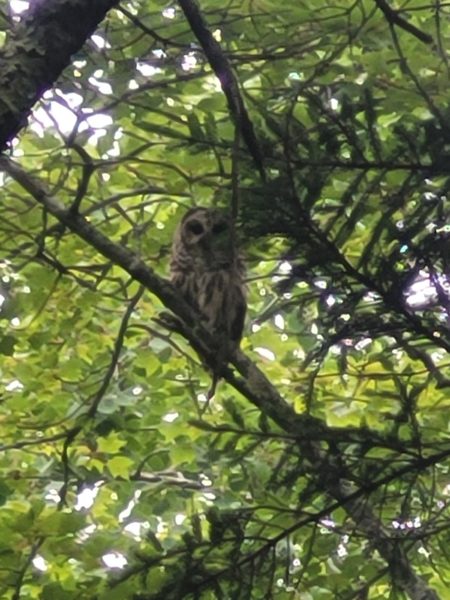
Barred Owl I spotted while hiking Salt Pond in July.
So Long, Salt Pond
Despite the short length of the Salt Pond hike, I find myself unable to give it proper due in a manageable number of words. Little encounters, like the barred owl that flew over my head or the vibrant mushrooms that lined the way, are but snippets of its broader story. As you go along, see if you can start identifying some of the species I discussed above. It’s easy to see needles and say “pine tree”, but that simplifies the ecological complexity of our woodlands. Salt Pond may be among the best hikes to test out the waters and start identifying.
Nature is complex and beautiful, after all, so why not see the forest for the trees?
Written by Michael Monaco-Vavrik, FBC’s 2023 Outreach and Education Intern. This blog is a part of his summer series, where he’ll be visiting many of FBC’s preserves and sharing his casual first-hand experiences. These may cover topics ranging from flora to fauna to history to general thoughts. By writing these pieces, he is hoping to inspire readers to go out and experience these preserves themselves. Is there a preserve you’d like him to cover? Send him a note at Michael@frenchmanbay.org.