Day Ridges Part 1: Cedars, Causeways, & Castor Canadensis
Maine is a state with a lot of land.
…Wait, hold on, don’t leave yet! I’m going somewhere with this, I swear.
Though rather small when compared to the western states, it makes up close to half of New England’s land area. It’s larger than the country of Scotland, and is home to a single county (Aroostook) that is greater in size than Connecticut and Rhode Island combined. The Northwoods cover millions of acres, Katahdin towers nearly a mile high, Mount Desert looms large above the surf–it’s all a fitting testament to scale.
But what good is “scale” when you’ve got a nine-to-five? You can’t hike the Hundred-Mile Wilderness when you’ve got taxes to pay and mouths to feed.
Well, I’m going to let you in on a little trade secret here: you don’t need to cover an English shire’s worth of area to explore nature. Every acre of forest, every parcel of grassland or mountain or mire, is a microcosm in itself. Even just a 20-30 minute hike can provide a meaningful nature experience. And nowhere is that clearer than Day Ridges Preserve in Gouldsboro.
Bridging the Ridges
Good tidings to you, dear reader. After months of fog and rain, it seems summer has finally arrived–the perfect time for me to regret not having air conditioning. I’d say “let’s hope it sticks around”, but, with this year’s luck, it’ll be 86° in November. And I left Philadelphia to avoid that.
But yes, back to the subject at hand. Day Ridges is a preserve that I’ve wanted to write about for a while now, and one that many of you may have visited. I initially planned to do a single post on this little gem, but with the preserve consisting of two parts–the hike and the paddle trail–I figured, why not both? That Part 2 should be coming a little later in the season. So, as my grandmother would say, andiamo–let’s go.
Local Geogridge-phy
(Ok, that header was painful to write).
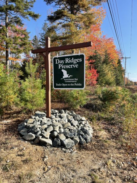
Day Ridges preserve is located predominantly in my hometown of Gouldsboro, between the exits for 195 and 186 East. However, a portion of the paddler’s trail slips into the unorganized territory of East Hancock. For those unfamiliar with the latter, it is a political division roughly the size of Androscoggin County (481 square miles), with a population of 85.(1) As you may guess, it gets a little wilder on the upper reaches of West Bay Pond.
The main artery of the Day Ridges Trail is the gated tote road, accessed directly from the parking lot. If you continue straight on this, you’ll eventually reach Lower West Bay Pond and the Day Ridges Paddler’s Trail–but I’ll save that for next time. For my first hike, the area of focus was instead the roughly 2-mile loop trail that branches off from the tote road. This trailhead, easily identifiable by a marker, can be found after a short walk along the tote road on the right-hand side.
A Day at the Ridges
 The loop trail begins by slowly rising through some well-drained conifer forest–-though you may initially hear the rush of cars along Route 1, this fades quickly. As you curve along the path, past some rocky ridges rising to your right, you’ll notice just how lush this forest is: mushrooms, ferns, mosses, trees in various states of life and death. This first section is particularly interesting in the autumn when the fungi come out in full-force. I was here last October and spotted vivid caps of all colors, shelf fungi, and even bright yellow staghorn mushrooms–I’d definitely recommend giving that a go.
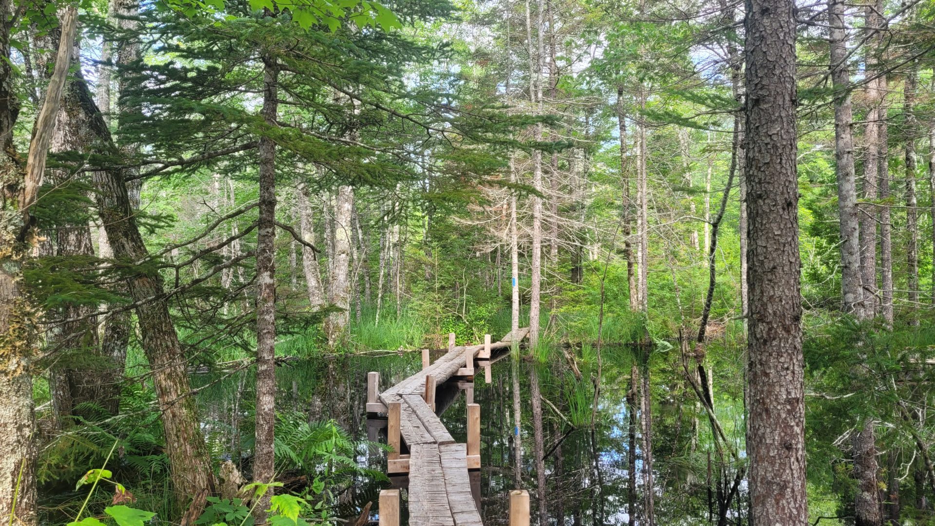
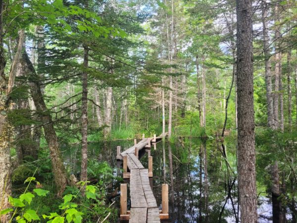
Not too long into the trail, things change quite radically. Whereas the first stretch has a dry uplands feel, it then descends into a picturesque cedar swamp. From a small vantage you can catch a glimpse of what looks like a flooded woodland. These skeletal trees have one particular resident to thank for this–but more on them later. Wood frogs, turtles, and salamanders thrive in this new habitat, and don’t be surprised if you hear a bullfrog’s baritone croak echo across the water. A little further ahead you will approach some bog bridging cutting through a dark, shallow lake. Of all the sections of the hike, this causeway has changed the most radically–and it also may be my favorite.
Not too far from here you’ll come to a fork in the road. I decided to take the right path, but they both lead back to the same place. Here it begins to rise once again, and you’ll notice some large boulders strewn around the area–these are glacial erratics. A glacial erratic is a large rock that has been picked up by a glacier and deposited some distance from its original location. Bubble Rock, over on Mount Desert, may be the most famous of these, but there’s no shortage at Day Ridges. You’ll also pass through some young forest, heavy with ferns and juvenile balsam fir and some bright red Wood, or Philadelphia, Lilies (Just for the record, I’ve never seen them down in Philly). Eventually you’ll come to more bog bridging around a massive erratic, and not too far ahead, you’ll arrive back at the tote road. Make a left, walk five minutes, and you’re at your car.
The Battle of the Beaver
Now, as you may have guessed, the extensive flooding and new marshland present here are the handiwork of our continent’s largest rodent: Castor canadensis, the North American beaver. Though Maine is now silly with these orange-toothed architects, that wasn’t always the case. In fact, beavers were almost entirely wiped out of the state.
In the early colonial history of North America, beaver pelts were the most sought-after commodity by trappers. Europe had developed a taste for the fur in the previous centuries, and, having driven the Eurasian Beaver to near extinction, they turned their hunger westward. By the start of the 20th century beavers were extirpated (regionally extinct) in most of coastal Maine.
But then something odd happened. After hundreds of years of wanton trapping and overhunting, opinion began to change. A push began to reintroduce the species to the fledgling Lafayette National Park (now Acadia), and between 1919 and 1923, a number of beavers were brought in. Several brutal, rodent-killing winters put a quick stop to this. Though these first attempts failed, by the mid 1920s a few hardy breeding pairs had succeeded and heralded the start of a population explosion. Soon MDI beavers were being shipped up and down the coast for reintroduction. Now, here in 2023, we can boast a thriving state-wide beaver population.

Beaver, in order to create suitable habitats and lodges, have turned to some rather ingenious methods. By creating large dams within water sources, they can effectively change the landscape at their will, even turning forests into marshes and ponds. The Day Ridges beavers are particularly active, and even since October things have changed quite a bit. While this does have the side effect of killing much of the ground vegetation in the area, it encourages the growth of aquatic species and amphibious animals. Nature isn’t clean or simple; sometimes things get a bit messy. But that’s simply the calculus of the wild.
At the End of the Day (Ridges)
I think what appeals to me most about Day Ridges is the sheer variety in landscape and biome across such a small area. Rocky uplands, dry conifer forest, flooded marshes and swamps…you could take a picture of any of these sections and convince me they were a hundred miles apart. But that’s what’s amazing about our planet. Nothing is ever cut-and-dry, nor can it really be simplified–a small hike can be a thriving world of its own. So, the next time you’re at Day Ridges, or really anywhere in the beautiful outdoors, take a moment and look past the acres and miles. I think you’ll find your little slice of the world just as fulfilling.
Written by Michael Monaco-Vavrik, FBC’s 2023 Outreach and Education Intern. This blog is a part of his summer series, where he’ll be visiting many of FBC’s preserves and sharing his casual first-hand experiences. These may cover topics ranging from flora to fauna to history to general thoughts. By writing these pieces, he is hoping to inspire readers to go out and experience these preserves themselves. Is there a preserve you’d like him to cover? Send him a note at Michael@frenchmanbay.org.